.png)
It's hard to remember that while we can see the world at any time from our smartphones, it wasn't all that long ago that privilege was only available to governments and researchers. Before Google Earth, satellite imagery was only shown in the news or documentaries and was limited to the area being discussed. But twenty years ago, Google launched Earth to the public, revolutionizing how we see our world and place in the cosmos.
While Google Maps launched slightly earlier and has a huge impact on how we get around, Google Earth has been a boon to first responders after natural disasters, scientists looking for features of the natural world, and tools to plan renewable energy installations without being on-site. It's one of the most important GEOINT programs ever created, but it came from humble beginnings before Google folded it into its suite of tools.
Related
20 years ago today, Google Maps went public and changed the way we navigate the world
Google Maps has changed the way we see the world and continues to be an indispensable tool for users around the world.
The forerunner to Google Earth
Keyhole was a nod to early surveillance satellites used by the U.S. military
 Source: Google
Google Earth has its roots in video games, with a stop along the way at the CIA's venture capital firm. The core technology that would become the geospatial mapping tool was developed at Intrinsic Graphics, but the board wanted to focus on 3D engines for games, so the GEOINT tool got spun out as Keyhole.
Funded by Sony, Nvidia, and yes, the CIA, the nascent company was run by John Hanke, who would go on to found Niantic Labs and create Pokémon Go. Bet you didn't realize throwing Pokeballs at AR characters with your phone mapped via GPS has long-standing ties to the U.S. Intelligence apparatus, but what didn't back in the early 00s when Keyhole was first put together.
The startup got worldwide attention by providing the fly-through 3D maps that CNN and other news broadcasters used heavily during the Iraq War. At the time, it was known as EarthViewer, and not long after that, Google purchased the company in an all-stock deal worth $35 million.
Related
Google Earth was a viral hit
So much so that the public launch was pushed back about a week due to server issues
 Source: Google
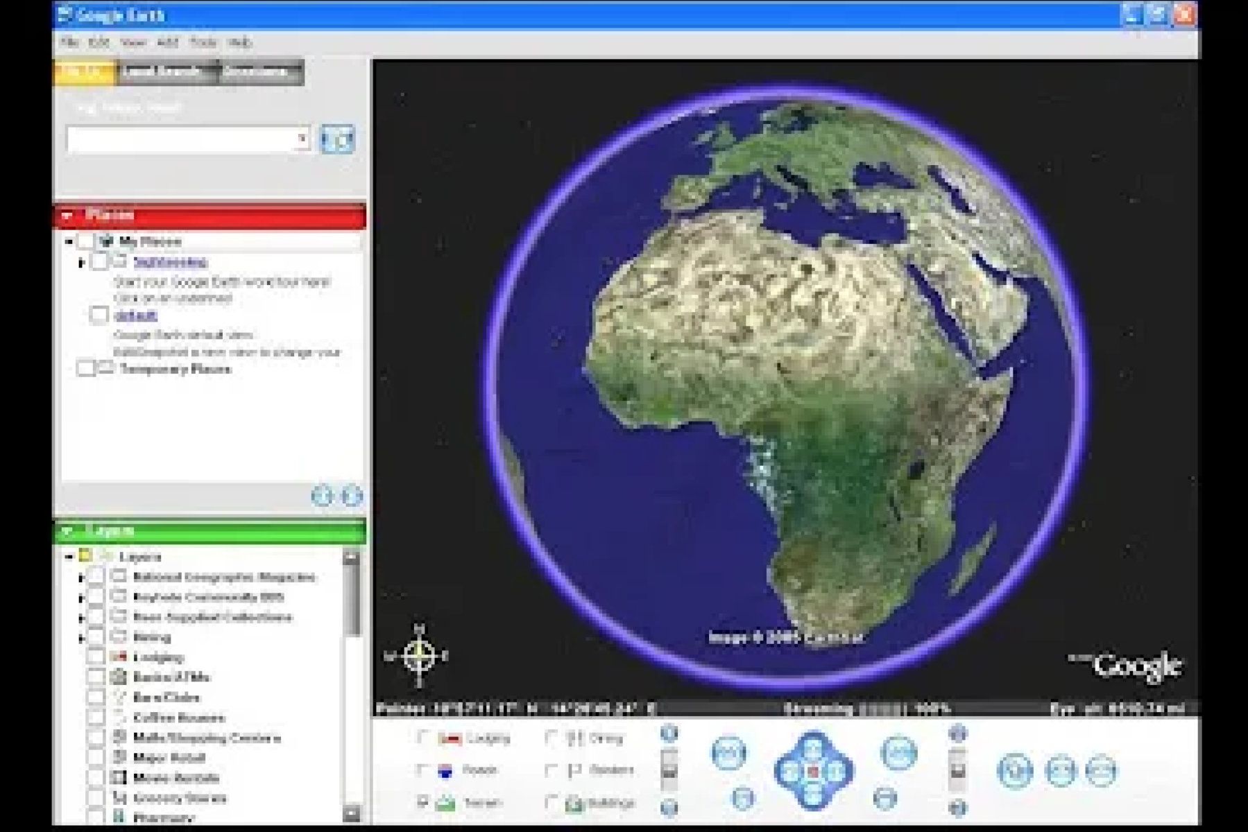
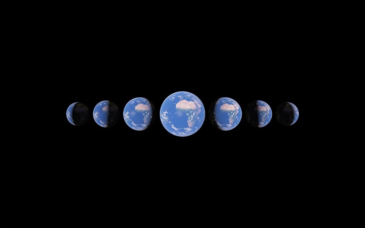
Depending on where you look, Google Earth launched either in June 2005 or the first week of July of that year. Technically, it was both as it was so successful at launch with over 100 million downloads of the desktop app (the web-based version wouldn't come until much later), that the servers couldn't cope and it got relaunched.
It was destined to be a curiosity at first, but then, in August 2005, Hurricane Katrina wiped much of the Gulf Coast of the U.S. flat, making things difficult for first responders to find victims, as street signs were gone, and they needed GPS coordinates. Part of the Google Earth team realized they could help by creating real-time imagery of the areas that they made public. Callers to 911 could say where they were, describe the local devastation, and responders could look at Google Earth and match the two together.
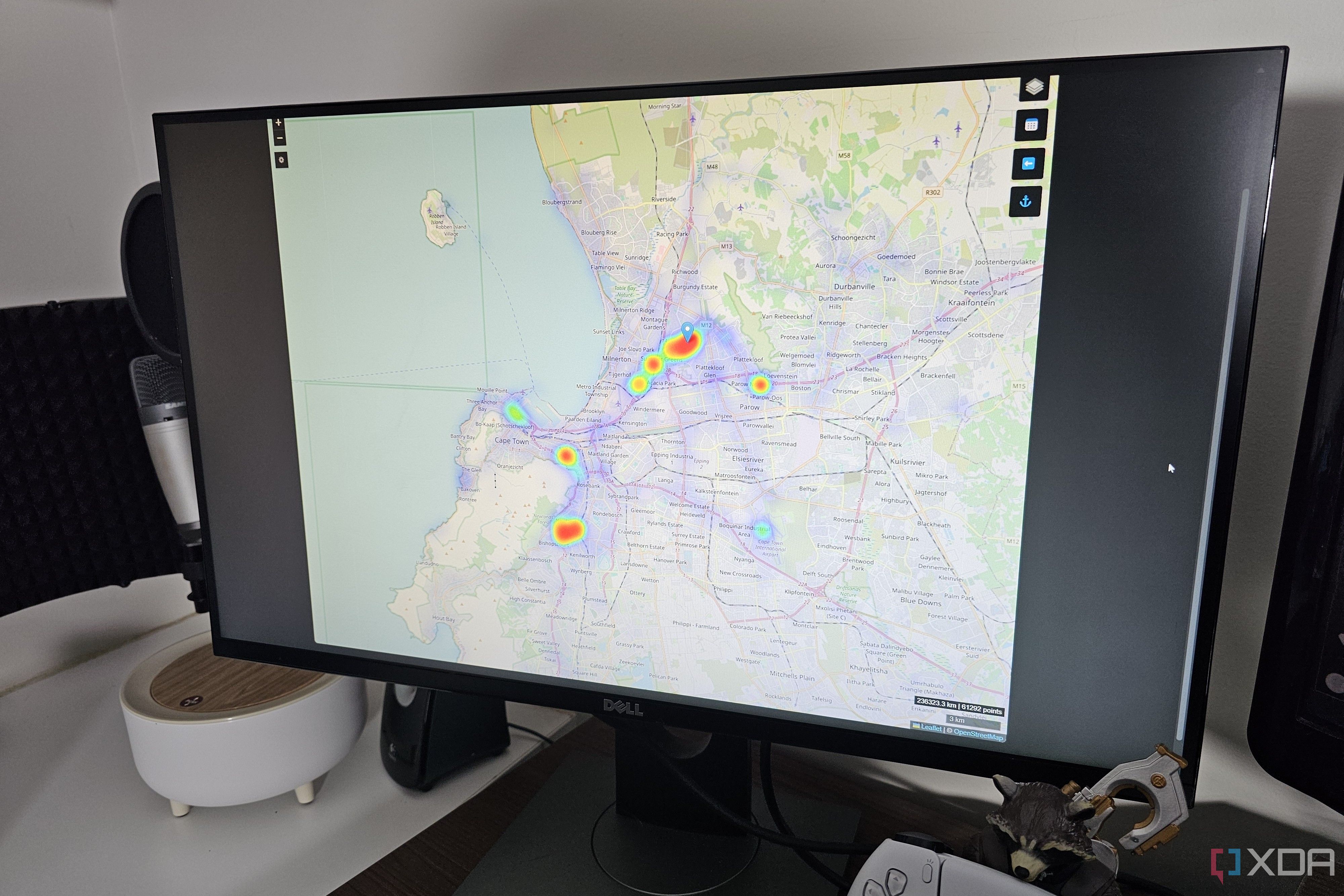
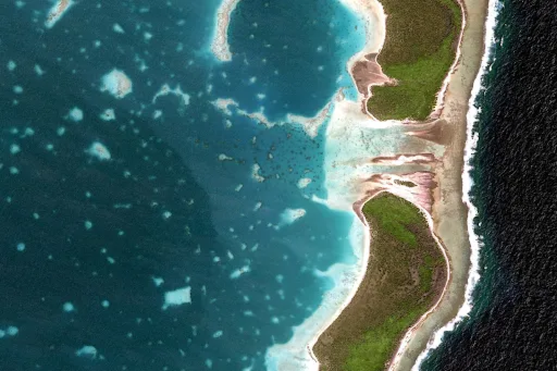
Over the years, Google Earth has been used by every level of government for disaster and public safety planning, military ops, and powerful visualizations used by news agencies and educators. What was once limited to major metro areas of the United States covers almost every square foot of the globe, with 3D imagery of buildings, foliage, and elevations. You can view things as if you were in space, or zoom in to street level with a few clicks, and move your viewpoint easily to get the angle you want.
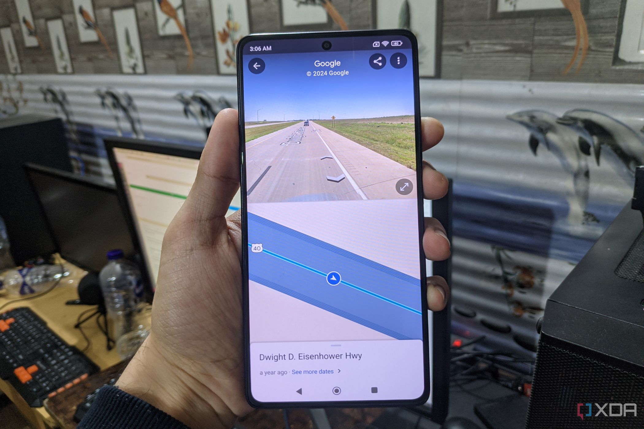
In 2017, Google integrated Google Earth into a webapp, which no longer needed a desktop app download. This version doesn't have the full functionality, but it runs from any browser, on devices that might not have been able to run the downloaded version.
Related
6 Google Sheets add-ons to improve your workflow
Take your productivity to the next level with these Google Sheets add-ons.
It does so much more than show you the world
But it can do that, too
Google Earth is a powerful tool for researchersbut also fantastic for creators. There's a spinoff called Google Earth Studio that lets you make zoom-in animations, spin around any landmarks you wish, or find out what that new location you want to do a photoshoot in will look like at different times of the day.
You can track urban expansion, explore the Moon, Mars, under the oceans, and things that don't appear on camera, like localized pollution levels. You can also track the rising sea level, migratory animals, changes to forest cover, and almost anything else you could want to track or think of tracking. It's not the only system for GEOINT around, but it's free for most users, and where else can you see Mt. Rushmore without leaving your living room?
Related
Google Earth’s new 3D time-lapse feature shows how much has changed over the years
Google Earth is adding a 3D time-lapse feature that shows how much our planet has changed since 1984.
Google Earth has shown us more in 20 years than many of us would see in a lifetime
Google Earth doesn't just have the data from when Keystone started collating Landsat data, it has millions of satellite images from 1984 onward. You can use this to see how parts of the world have changed in the last 40 years, and who knows what it will uncover in another twenty years? It's an amazing learning resource that Google has enabled for free, and I remember being absolutely hooked when it first came out. It's a reminder that Google isn't all about selling advertising; sometimes, it does cool things for the benefit of everyone.


 English (US) ·